REALSTACK Releases New Product: Properties Map Search
REALSTACK now offers the industry-leading interactive properties map for searching land!
Map Search Key Benefits
- The most advanced map search user experience in the industry
- Make a strong impression on website visitors
- Invest in the latest mapping technology to separate from your competitors
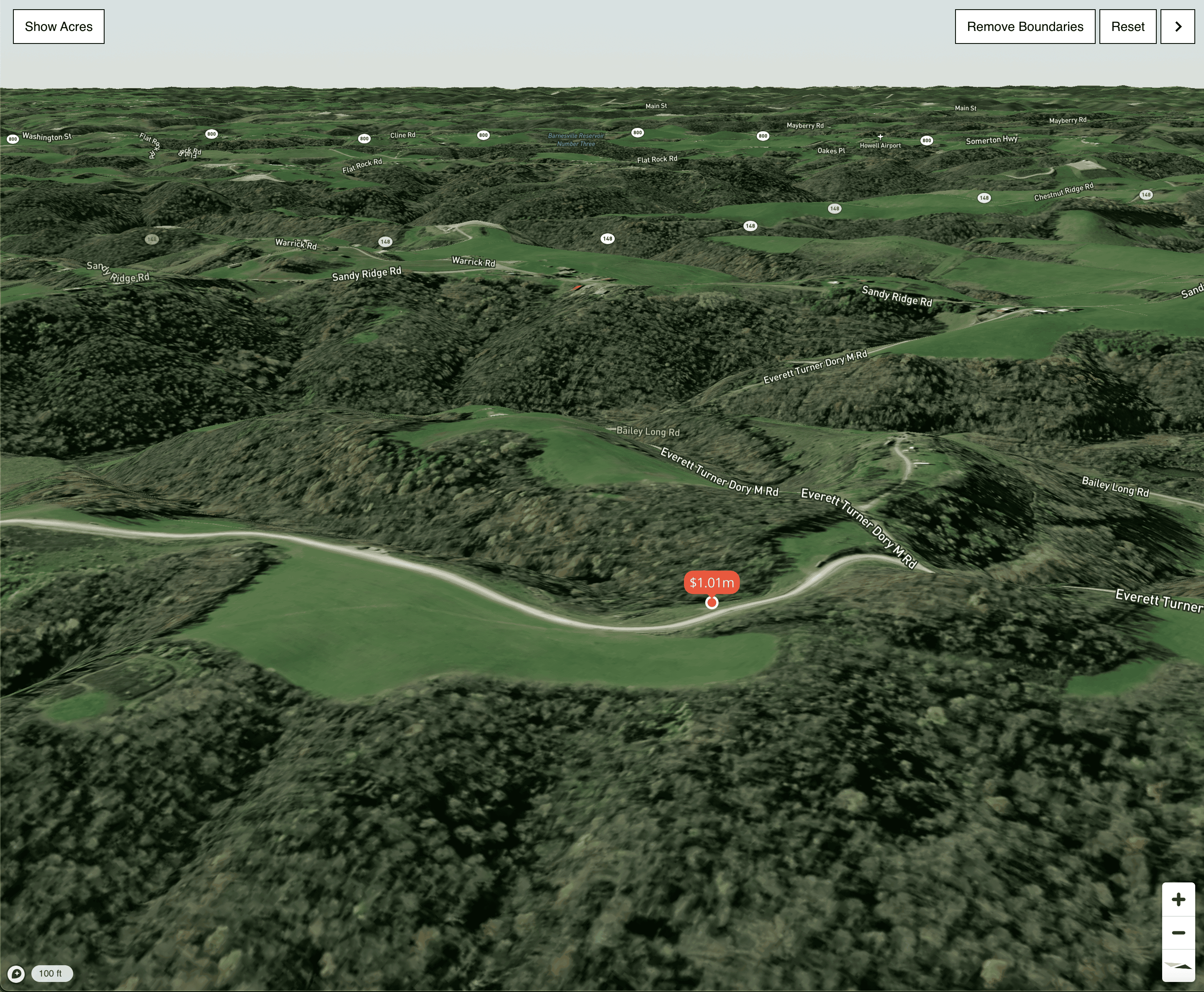
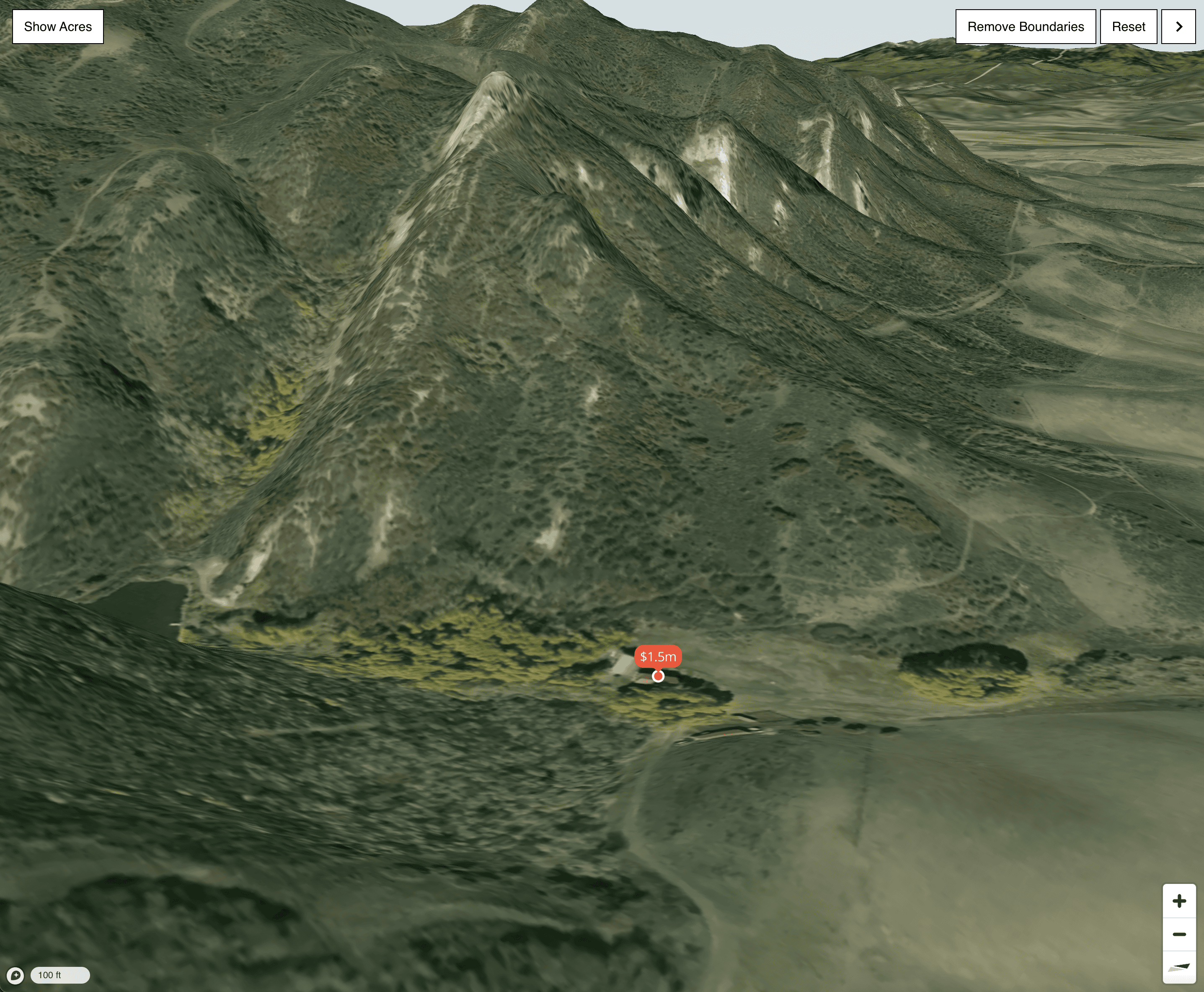
- Pan, tilt, and zoom in 3D for the best property experience outside of a showing
- Mobile map experience
- Can increase time-on-site and engagement
- Drive engagement with a map designed for land shopping
- Available with MLS IDX websites (add-on)
Map Search Features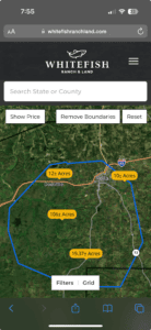
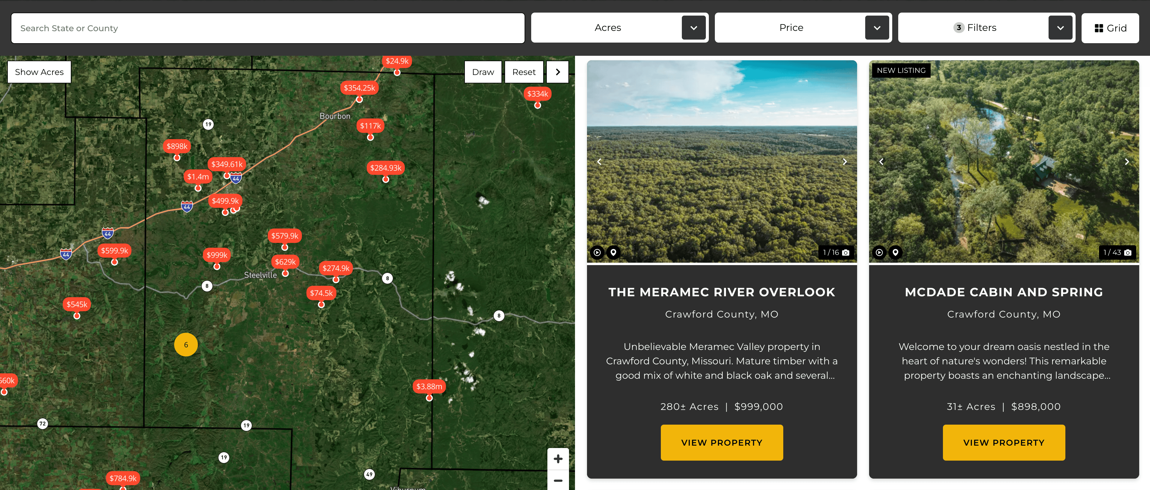
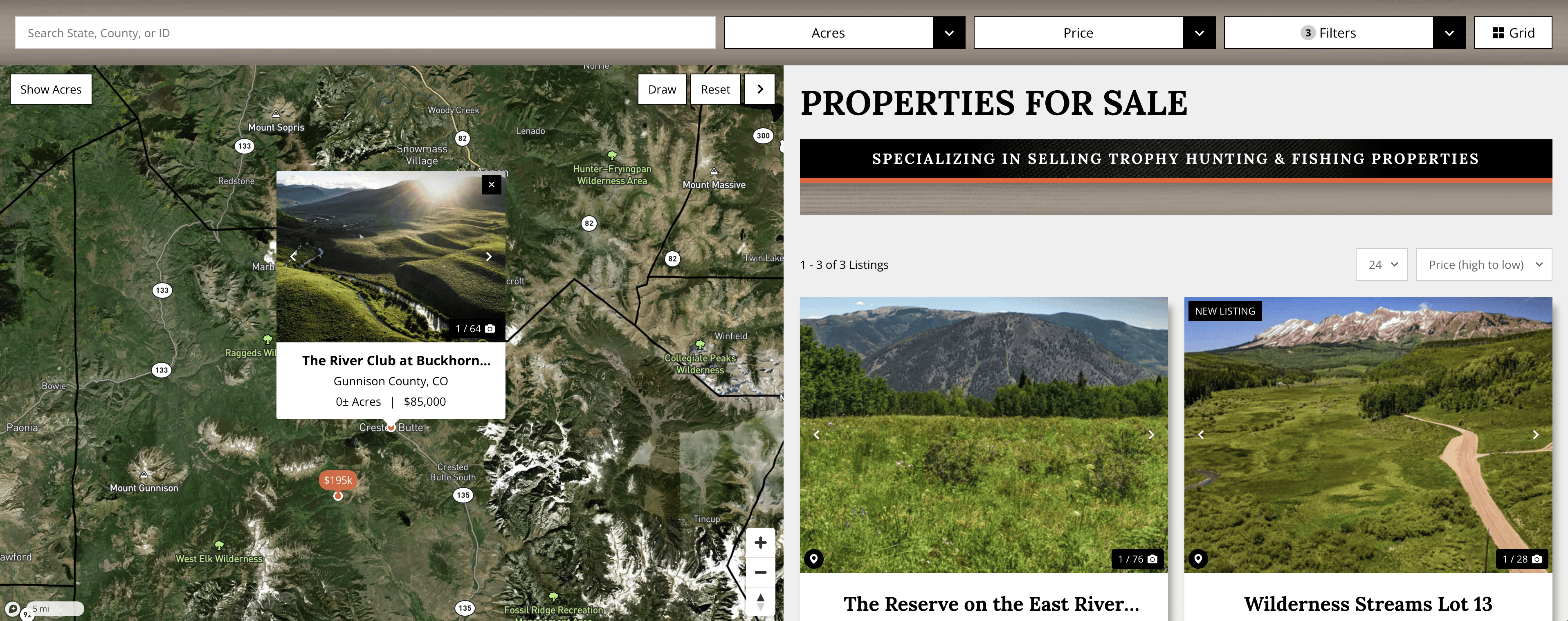
Display each property’s boundary – The REALSTACK properties map feature can display your property’s exact boundaries on the map if you upload the KML file into the REALSTACK system.
Mobile full map search functionality – The REALSTACK map search feature allows you to have a full-functioning map on mobile devices like desktops. It includes features like zoom, pan, tilt, filter, and more!
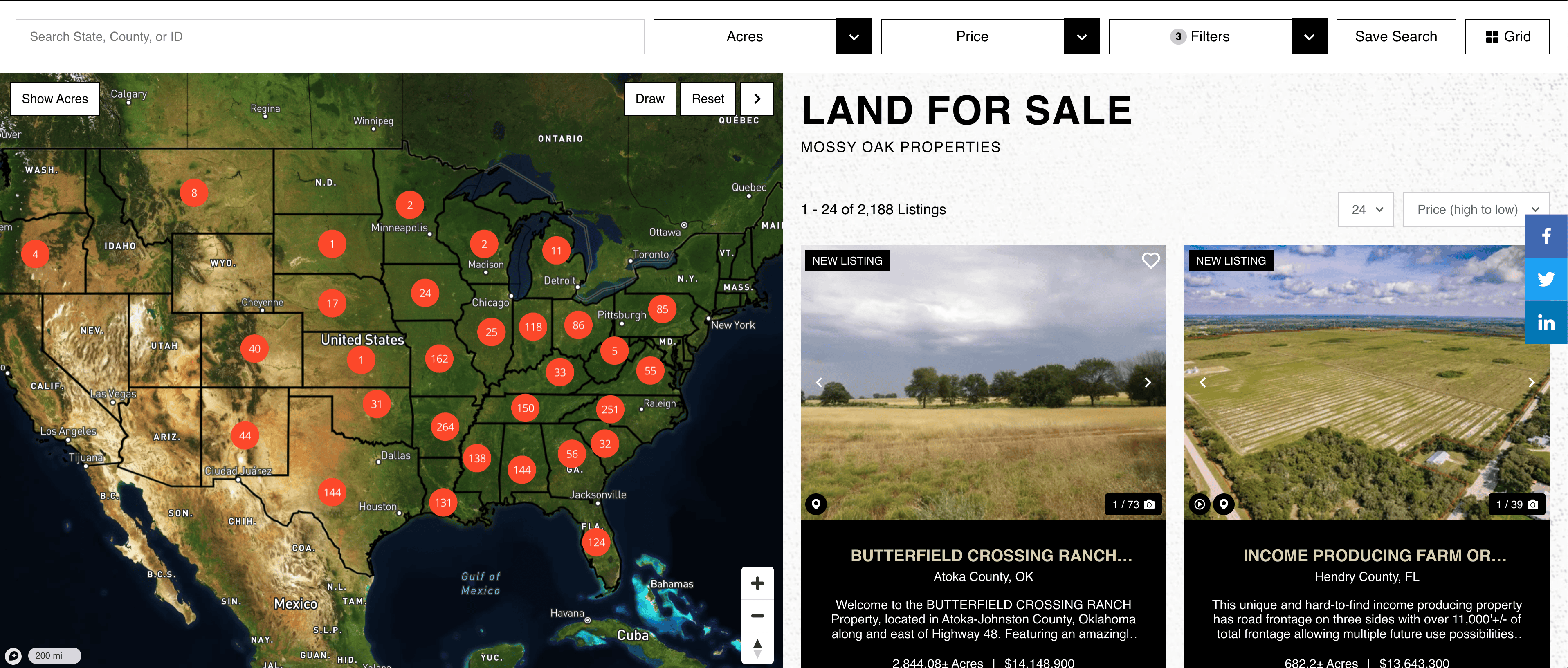
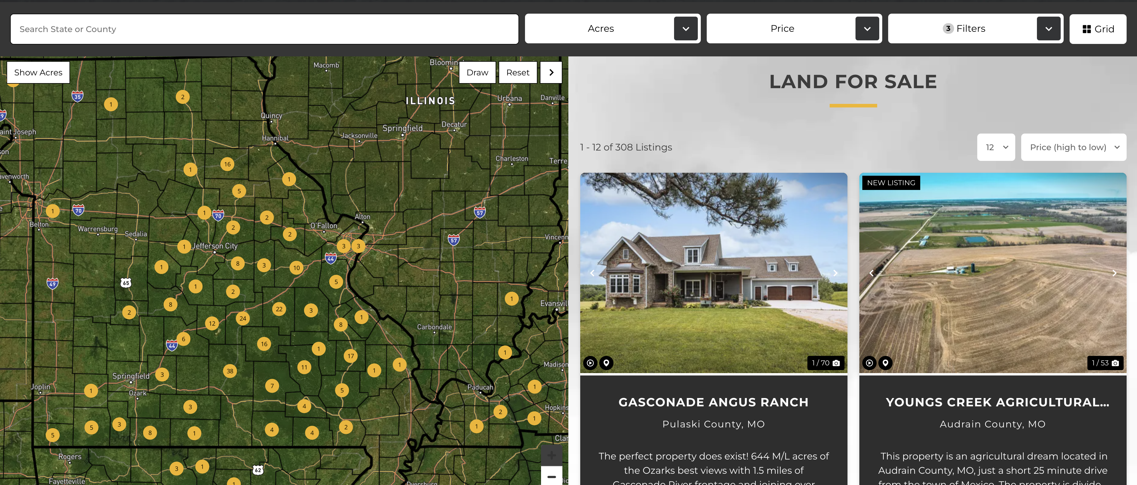
Displays state and county boundaries – The properties map system displays all state and county boundaries on the map so that land brokerage website visitors can easily understand the area they are searching.
One-click state and county for instant zoom and search filtering – You can click just once on any state or county, and the map will zoom into that state or boundary and show you the available properties for your selection.
Fully integrated text search, map click filters, and advanced search – The search bar on the map automatically filters the county or state being searched, and visitors can filter the map by area, county, acres, price, and more advanced features.
Map auto-zooms based on text search and map click filters – The map is connected to the search bar, so it will automatically update as you search for a specific state or county on the map. Showing you exactly what you are looking for.
Draw custom boundary search – REALSTACKS property map search allows you to draw a polygon boundary to search for properties in a specific area.
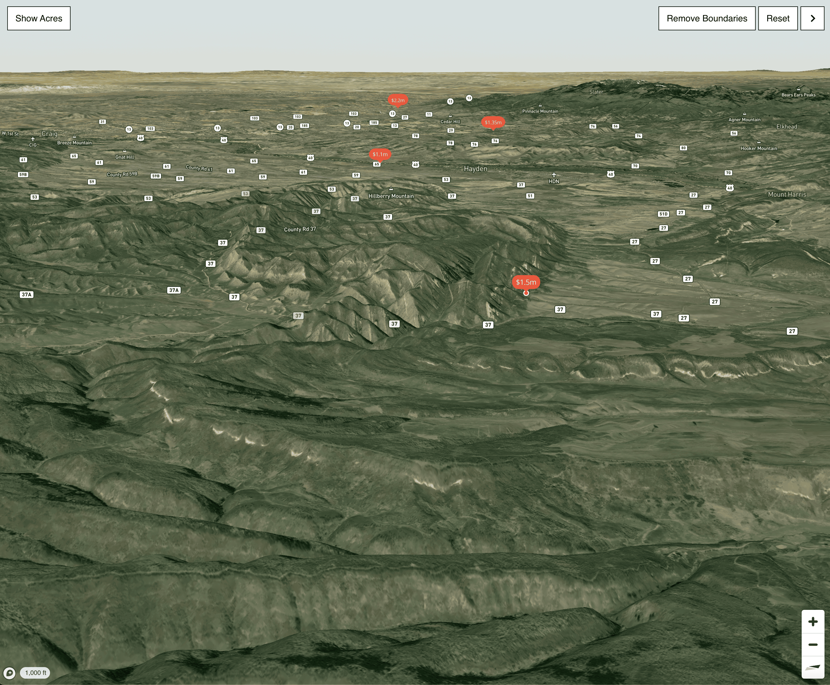
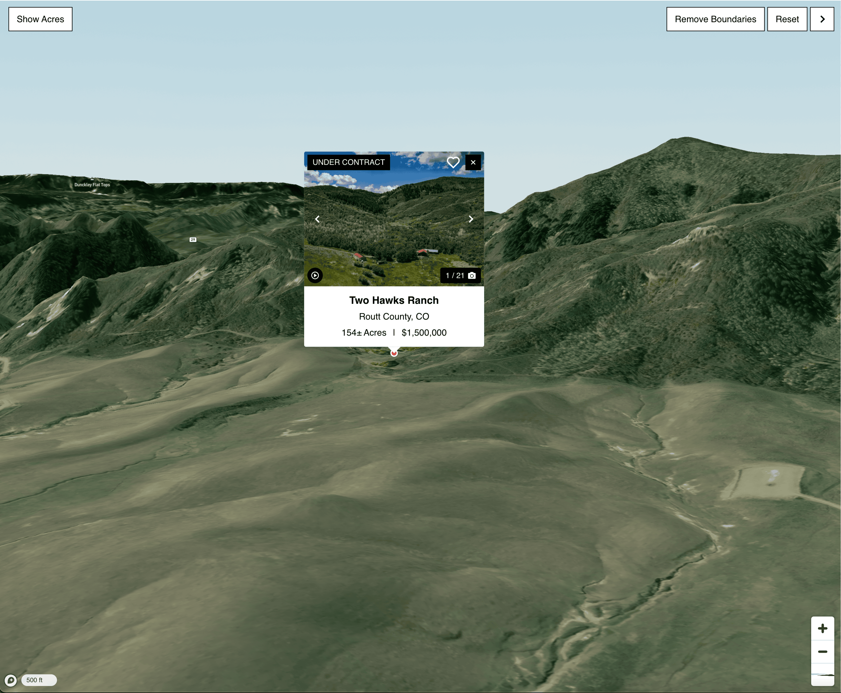
3D tilt, zoom, and pan for maximum property visualization – The feature allows your website visitors to visualize exactly what the properties they are looking for look like. The map can zoom, pan, tilt, and go into 3D mode in order to get a better view of what the topography of a property is like.
Watch Properties Map Search Demo Video
Ready for Properties Map Search on your Website?
Request a Properties Map Search demo. Take advantage of this opportunity to invest in the latest mapping technology to separate from your competitors! Our team is standing by to talk about Properties Map Search with you. Contact the REALSTACK team to make it happen today.